
Uptown Sedona, Airport Loop and Montezuma’s Well
Last night I tossed and turned. We had thunderstorms and heavy rain in the early morning hours – both of which kept trying to wake me up. Became fully awake around 530am – I suppose the jet lag is getting a little better! At 7 am we met for breakfast at the hotel and tentatively planned the day. We took off at 830 to visit the Hike House, which is supposed to be one of the best hiking stores in AZ. At first I was a bit disappointed. It was a small store that carried minimal basic things. However, once wondered into the cafe area and began talking to some of the gentlemen there about the hikes and trails in the area, we received invaluable advice. If you are interested in a group guided hike – this is the place to go, too.
As the weather was supposed to remain poor for a few more hours we decided to stop by Uptown Sedona and explore the shops there. Crystal shops, souvenir shops, T shirt shops….. they were all there. If you are a chocoholic – you must go to the Chocolate shop – just the smell as you walk by is amazing!
From Uptown Sedona, we headed to the airport to hike the airport loop. About 1/2 way p the hill of 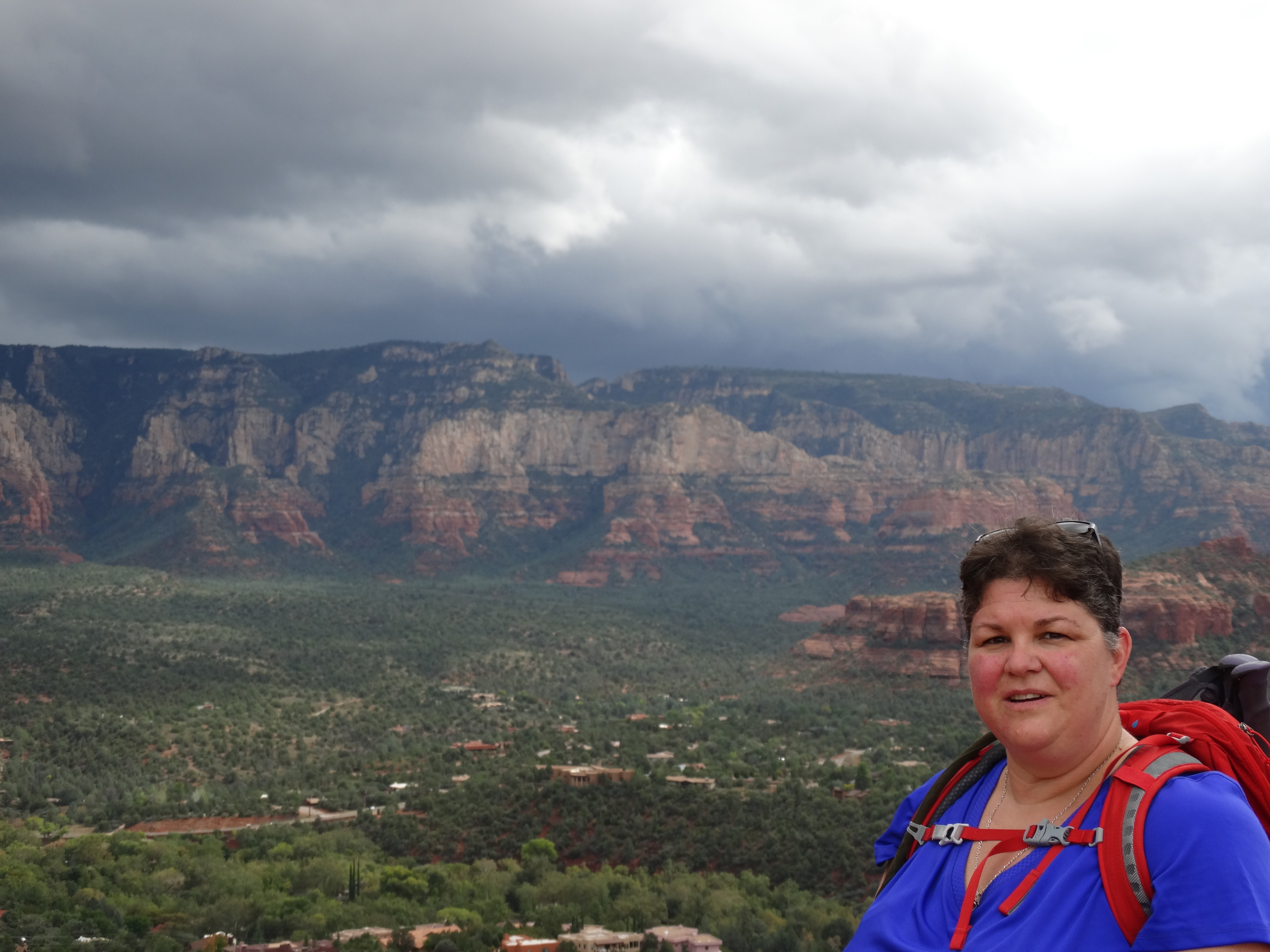 Airport Rd is a small parking area. This has a short trail to the summit of a large “boulder” (for lack of a better word), and the best place to pick up the airport loop. However, if you don’t mind adding a short distance to your hike, continue driving up the hill and park at the large parking lot on the left by the airport. There is a scenic overlook just across the road from the parking lot that is a must see. The views of Sedona are spectacular.
Just near the road crossing is the trailhead for the trail back down to Summit Trail and Airport Loop. From the rains earlier in the day, the group was quite slippery and muddy, but the going wasn’t too bad since it was down hill. When we walked the .6 miles to the first parking lot, we walked up Summit Trail (very short and quite steep at the top) to the top of the boulder. From there we could see about 240 degrees around. The storm clouds in the distance were rumbling thunder and you could see lightening. Yet on the other side, there were patches of lightened sky – not quite sunny, but almost. Our group sat up here and ate a quick lunch before moving on.
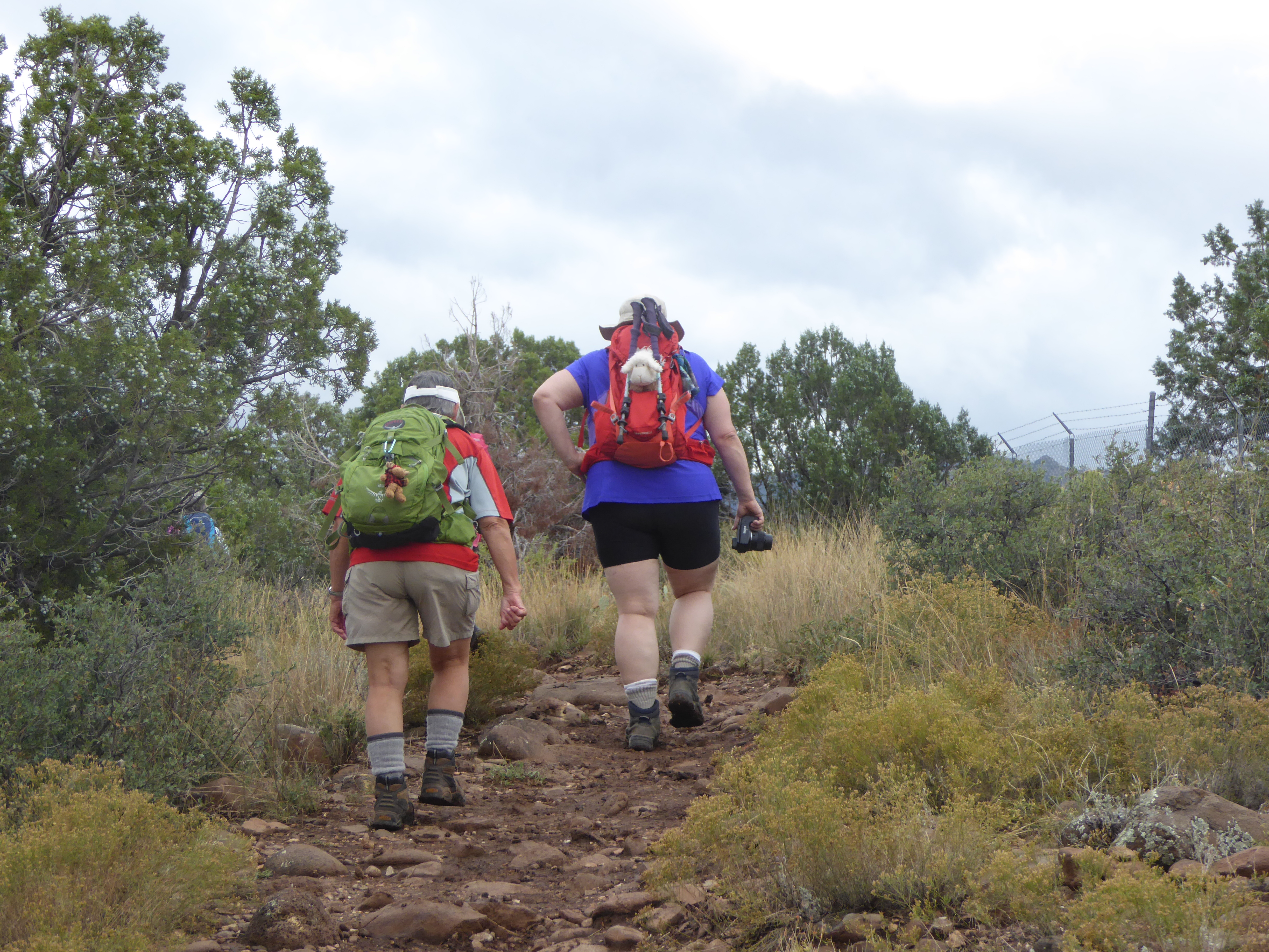 Once down off the Summit, we picked up the West side of Airport Loop. I would highly recommend walking the Airport Loop in a clockwise fashion. This way, the views of Twin Butte, Courthouse Butte, Bell Rock and Cathedral rock all remain ahead of you while they can be seen. The trial is very narrow and has a steep drop-off on one side. If you have troubles with heights and/or ledges, this can be challenging. As you come to the end of the West side of the trail, it begins a section of uphill that can be a bit steep in areas. As we were walking along here, the rains came to us. For just a little bit, it became very dark and I was just a little bit frightened that it would be lightening – considering that we were the tallest things on the side of a butte carrying metal hiking poles – we weren’t in a very good position. However, the rains passed as we rounded the butte and headed down the east side. The east side started with a down hill portion, then made it’s way back uphill, meeting Airport Road just across the street from the lower parking lot. The entire loop was 3.3 miles. We took another break at this overlook before heading back up the saddle trail to the upper parking lot. Once there, we scraped the mud off our boots, and made plans to head back to the hotel.
 Originally, we had thought to hike Soldiers Pass today as well, but we didn’t finish Airport loop until 3pm and the sun sets around 6pm and we didn’t want to be finishing that hike in the dark. Instead, we decided to stop by Montezumas Well on the way back to the hotel. This is an must see! Montezumas Well is a natural spring that has been there for thousands of years. There is a constant uprising of water from vents in the bottom that supplies the well. There is a small channel that carries the water off and out Beaver Creek. From the rim of the well, there are steps to hike down into the well. There is evidence of ancient dwellings at the bottom. I could have spent hours there exploring and looking at everything. There are only 100 steps down into the well – not too many to climb back up. The rest of the trail has lots of signs telling about the plant life in the area, answering many questions about what was what.
We made it back to the hotel to clean up and decided to just walk across the street for supper at Denny’s. Now it is 8pm and I am more than ready to climb in bed!